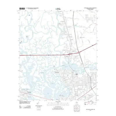
2012 Map of Pascagoula North
USGS Topo · Published 2012About this map
Moss Point and Escatawpa define the industrial and residential heart of this coastal river network, where the Pascagoula River and the Escatawpa River converge. This 2012 survey illustrates the complex relationship between land and water in Jackson County, showing a landscape fragmented by dozens of named bayous, including Buzzard Bayou and Creole Bayou, alongside large interior water bodies like Big Lake.
Find a feature on this map
244 named features on this map. Tap any name to fly to it.
Don’t see what you’re looking for? This feature index may not catch every label — zoom into the map to look around manually.
Map Details
Editions of this 2012 Pascagoula North Map
This is the sole edition of this map. No revisions or reprints were ever made.
Other maps of this area

1921 · Grand Bay
USGS Topo · 1:62,500

1941 · Hurley
USGS Topo · 1:62,500

1941 · Vancleave
USGS Topo · 1:62,500

1943 · Pascagoula
USGS Topo · 1:62,500

1943 · Grand Bay
USGS Topo · 1:62,500

1943 · Hurley
USGS Topo · 1:62,500

1943 · Vancleave
USGS Topo · 1:62,500

1944 · Vancleave
USGS Topo · 1:62,500

1953 · Mobile
USGS Topo · 1:250,000

1955 · Pascagoula
USGS Topo · 1:62,500