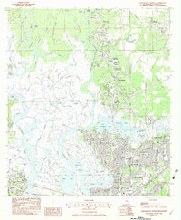
1982 Map of Pascagoula North
USGS Topo · Published 1983About this map
The branching waterways of the Pascagoula West River and Little River define this coastal Mississippi landscape in the early 1980s. A intricate network of bayous, including Whiskey Bayou and Creole Bayou, weaves through the marshlands between the growing centers of Escatawpa, Moss Point, and Pascagoula. The map reveals a community organized around its riverbanks and rail lines, most notably the Louisville and Nashville corridor cutting through the southern reach. Local history and genealogy researchers will find significant detail in the numerous burial grounds, such as Mormon Cem, Griffin Cem, and Evergreen Memorial Gardens. The infrastructure of the era is well-represented, from the Singing River Hosp to a collection of neighborhood schools like Kreole Sch and Magnolia Jr High Sch, reflecting the residential expansion near the industrial riverfronts.
Find a feature on this map
93 named features on this map. Tap any name to fly to it.
Don’t see what you’re looking for? This feature index may not catch every label — zoom into the map to look around manually.
Map Details
Editions of this 1982 Pascagoula North Map
This is the sole edition of this map. No revisions or reprints were ever made.
Other maps of this area

1921 · Grand Bay
USGS Topo · 1:62,500

1941 · Hurley
USGS Topo · 1:62,500

1941 · Vancleave
USGS Topo · 1:62,500

1943 · Pascagoula
USGS Topo · 1:62,500

1943 · Grand Bay
USGS Topo · 1:62,500

1943 · Hurley
USGS Topo · 1:62,500

1943 · Vancleave
USGS Topo · 1:62,500

1944 · Vancleave
USGS Topo · 1:62,500

1953 · Mobile
USGS Topo · 1:250,000

1955 · Pascagoula
USGS Topo · 1:62,500