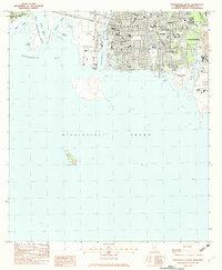
1982 Map of Pascagoula South
USGS Topo · Published 1982About this map
Industrial and maritime development dominate this coastal survey, where the Shipbuilding Plant sits at the mouth of the Pascagoula River. The city of Pascagoula is shown in detail, revealing a dense grid of residential streets like Boston Ave and Nashville Ave, interspersed with numerous local institutions such as Lanier Colmer Jr High Sch and Sacred Heart Sch. This period marks a significant era of educational and civic expansion in the region.
Find a feature on this map
52 named features on this map. Tap any name to fly to it.
Don’t see what you’re looking for? This feature index may not catch every label — zoom into the map to look around manually.
Map Details
Editions of this 1982 Pascagoula South Map
2 editions found
Other maps of this area

1921 · Grand Bay
USGS Topo · 1:62,500

1921 · Petit Bois Island
USGS Topo · 1:62,500

1941 · Horn Island
USGS Topo · 1:62,500

1942 · Petit Bois Island
USGS Topo · 1:62,500

1942 · Horn Island
USGS Topo · 1:62,500

1943 · Pascagoula
USGS Topo · 1:62,500

1943 · Grand Bay
USGS Topo · 1:62,500

1953 · Mobile
USGS Topo · 1:250,000

1955 · Pascagoula
USGS Topo · 1:62,500

1957 · Mobile
USGS Topo · 1:250,000
Featured Places
- Pascagoula, MS
- Gautier, MS
- East Pascagoula, Pascagoula
- South Pascagoula, Pascagoula
- East Side, Pascagoula