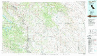
1989 Map of Paso Robles
USGS Topo · Published 1989About this map
The Salinas River valley serves as the central corridor for this 1989 topographic survey, where the Southern Pacific railroad and U S 101 connect the regional hubs of Paso Robles, Atascadero, and Templeton. To the west, the landscape is defined by the steep Santa Lucia Range and the waters of Nacimiento Reservoir and San Antonio Reservoir. The map illustrates a transitional economy of agriculture and defense, notably centered on the sprawling Camp Roberts Military Reservation near San Miguel.
Find a feature on this map
72 named features on this map. Tap any name to fly to it.
Don’t see what you’re looking for? This feature index may not catch every label — zoom into the map to look around manually.
Map Details
Editions of this 1989 Paso Robles Map
This is the sole edition of this map. No revisions or reprints were ever made.
Other maps of this area

1897 · San Luis Obispo
USGS Topo · 1:62,500

1897 · Cayucos
USGS Topo · 1:62,500

1900 · San Luis
USGS Topo · 1:125,000

1912 · Coalinga
USGS Topo · 1:125,000

1912 · San Ardo
USGS Topo · 1:31,680

1912 · McKittrick
USGS Topo · 1:125,000

1914 · Lost Hills
USGS Topo · 1:125,000

1914 · Cholame
USGS Topo · 1:125,000

1915 · Priest Valley
USGS Topo · 1:125,000

1915 · Cholame
USGS Topo · 1:125,000