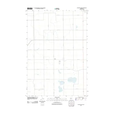
2010 Map of Patchen Lake
USGS Topo · Published 2010About this map
Roseville Cemetery and Brennin Cemetery sit centrally located in this section of Grant County, serving as vital landmarks for genealogists and local historians. The landscape is defined by the glacial geography typical of the region, featuring significant water bodies such as Patchen Lake, Shauer Lake, and Silver Lake in the southern reaches. The Pomme de Terre River cuts through the northeastern corner, anchoring the local drainage system. A strictly organized grid of township and county roads, including County Hwy-35 and Twp Hwy 41, facilitates movement across the agricultural terrain. The map terminates at the southern border along Stevens Co Line Rd, marking the political boundary between Grant and Stevens counties during this modern era of precision surveying.
Find a feature on this map
26 named features on this map. Tap any name to fly to it.
Don’t see what you’re looking for? This feature index may not catch every label — zoom into the map to look around manually.
Map Details
Editions of this 2010 Patchen Lake Map
This is the sole edition of this map. No revisions or reprints were ever made.
Other maps of this area

1910 · Chokio
USGS Topo · 1:62,500

1911 · Barrett
USGS Topo · 1:62,500

1911 · Herman
USGS Topo · 1:62,500

1912 · Chokio
USGS Topo · 1:62,500

1912 · Morris
USGS Topo · 1:62,500

1953 · Milbank
USGS Topo · 1:250,000

1953 · Saint Cloud
USGS Topo · 1:250,000

1957 · Saint Cloud
USGS Topo · 1:250,000

1958 · Milbank
USGS Topo · 1:250,000

1958 · Saint Cloud
USGS Topo · 1:250,000