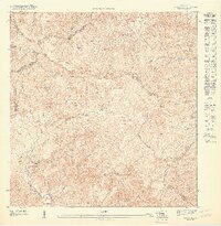
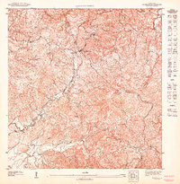
1947 Map of Patillas NE
USGS Topo · Published 1947About this map
The Sierra de Cayey dominates this 1940s topographic study, defining the high-altitude divide between numerous municipalities in southeastern Puerto Rico. Much of the western territory is protected as the Bosque Insular de Carite, a landscape of dense tropical forest and steep ridgelines that feed the headwaters of major river systems. The Rio Grande de Patillas flows southward toward the coast, while the Rio Grande de Loiza begins its northward journey on the opposite side of the continental divide.
Find a feature on this map
28 named features on this map. Tap any name to fly to it.
Don’t see what you’re looking for? This feature index may not catch every label — zoom into the map to look around manually.
Map Details
Editions of this 1947 Patillas NE Map
This is the sole edition of this map. No revisions or reprints were ever made.
Other maps of this area

1946 · Patillas
USGS Topo · 1:30,000

1946 · Juncos
USGS Topo · 1:30,000

1946 · Yabucoa
USGS Topo · 1:30,000

1946 · Caguas
USGS Topo · 1:30,000

1947 · Yabucoa SO
USGS Topo · 1:10,000

1947 · Patillas SO
USGS Topo · 1:10,000
1947 · Patillas SE
USGS Topo · 1:10,000
1947 · Juncos SO
USGS Topo · 1:10,000
1947 · Patillas NO
USGS Topo · 1:10,000
1947 · Caguas SO
USGS Topo · 1:10,000
Featured Places
- Sector Goyo Rosario, San Lorenzo
- Sector Campo Alegre, San Lorenzo
- Sector Sonadora, Patillas
- Villa Kike, San Lorenzo
- Caguas