
1956 Map of Patroon
USGS Topo · Published 1957About this map
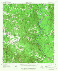
Sabine River bottomlands and the dense pine woods of the Sabine National Forest dominate this mid-century look at the border between Texas and Louisiana. The map reveals a landscape defined by its waterways, where the river winds through complex formations like Silvie Bend and Buzzard Bend, flanked by numerous sloughs and oxbow lakes such as San Patricio Lake and Tiger Lake Slough. In this era before major reservoir development, the natural flow of the river dictates the settlement patterns on both sides of the state line.
Find a feature on this map
76 named features on this map. Tap any name to fly to it.
Don’t see what you’re looking for? This feature index may not catch every label — zoom into the map to look around manually.
Map Details
Editions of this 1956 Patroon Map
4 editions found
Other maps of this area

1941 · Zwolle
USGS Topo · 1:62,500

1941 · Pelican
USGS Topo · 1:62,500

1943 · Pleasant Hill
USGS Topo · 1:62,500

1944 · Negreet
USGS Topo · 1:62,500

1944 · Logansport
USGS Topo · 1:62,500

1944 · Patroon
USGS Topo · 1:62,500

1944 · Zwolle
USGS Topo · 1:62,500

1944 · Pleasant Hill
USGS Topo · 1:62,500

1953 · Alexandria
USGS Topo · 1:250,000

1953 · Palestine
USGS Topo · 1:250,000