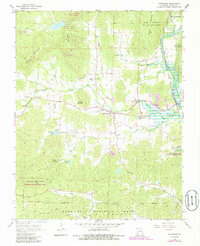
1968 Map of Patterson
USGS Topo · Published 1985About this map
Patterson serves as the central hub of this Missouri landscape, situated near the intersection of several notable stream valleys and forested hills. In the late 1960s, the community was supported by local landmarks like Lebanon Ch and a series of rural burying grounds including English Cem and Sparks Cem. The eastern portion of the area is dominated by the waters of Lake Wappapello and the St Francis River, which feed into several state wildlife management areas. This map reveals a terrain where early settlement patterns followed the creeks, evidenced by clusters of cemeteries and churches such as Rings Creek Ch and Little Lake Creek Ch. The presence of the Julian Lookout Tower and features like Yancey Cave highlight the dual nature of the region as both a managed forest resource and a site of natural interest within the Mark Twain National Forest.
Find a feature on this map
46 named features on this map. Tap any name to fly to it.
Don’t see what you’re looking for? This feature index may not catch every label — zoom into the map to look around manually.
Map Details
Editions of this 1968 Patterson Map
3 editions found
Other maps of this area

1926 · Des Arc
USGS Topo · 1:62,500

1929 · Des Arc
USGS Topo · 1:62,500

1930 · Coldwater
USGS Topo · 1:62,500

1932 · Piedmont
USGS Topo · 1:62,500

1934 · Greenville
USGS Topo · 1:62,500

1935 · Piedmont
USGS Topo · 1:62,500

1939 · Greenville
USGS Topo · 1:62,500

1949 · Rolla
USGS Topo · 1:250,000

1949 · Coldwater
USGS Topo · 1:62,500

1953 · Rolla
USGS Topo · 1:250,000