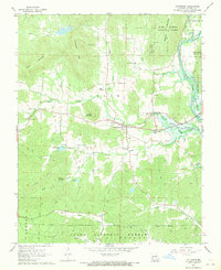
1968 Map of Patterson
USGS Topo · Published 1969About this map
Patterson serves as the central hub of this late-1960s Ozark landscape, where the confluence of several creeks meets the western reaches of Lake Wappapello. The area is defined by a series of family-named peaks and ridges, including Haley Mountain, Daffron Mountain, and Wilcox Mountain, which overlook a network of valley settlements. This geography supported a traditional rural infrastructure of small churches and family burial grounds, such as Rings Creek Ch, English Cem, and Jones Cem, many of which are situated along the winding paths of Logan Creek and Rings Creek.
Find a feature on this map
42 named features on this map. Tap any name to fly to it.
Don’t see what you’re looking for? This feature index may not catch every label — zoom into the map to look around manually.
Map Details
Editions of this 1968 Patterson Map
3 editions found
Other maps of this area

1926 · Des Arc
USGS Topo · 1:62,500

1929 · Des Arc
USGS Topo · 1:62,500

1930 · Coldwater
USGS Topo · 1:62,500

1932 · Piedmont
USGS Topo · 1:62,500

1934 · Greenville
USGS Topo · 1:62,500

1935 · Piedmont
USGS Topo · 1:62,500

1939 · Greenville
USGS Topo · 1:62,500

1949 · Rolla
USGS Topo · 1:250,000

1949 · Coldwater
USGS Topo · 1:62,500

1953 · Rolla
USGS Topo · 1:250,000