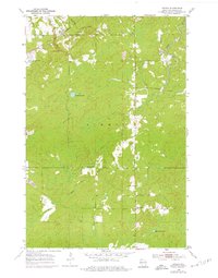
1954 Map of Patzau
USGS Topo · Published 1976About this map
Patzau is situated in the northwest corner of this Wisconsin-Douglas County study, serving as a focal point for the surrounding Summit area. The landscape is defined by the winding course of the Black River and numerous small water bodies, including Summit Lake and Lake Seventeen. Cultural life in the mid-20th century is evident through the presence of rural infrastructure such as the Town Hall, McCreary Sch, and Chaffey Sch. An Old Railroad Grade cuts through the northern sections, tracing a former transport corridor through the timber and marshland. This edition also includes revisions from the mid-1970s, noting modern additions like the Television Tower and several gravel pits, which mark the gradual shift from a purely agricultural and forestry-based economy toward more industrial land use.
Find a feature on this map
15 named features on this map. Tap any name to fly to it.
Don’t see what you’re looking for? This feature index may not catch every label — zoom into the map to look around manually.
Map Details
Editions of this 1954 Patzau Map
4 editions found
Other maps of this area

1915 · Superior
USGS Topo · 1:48,000

1917 · Superior
USGS Topo · 1:62,500

1949 · Holyoke
USGS Topo · 1:48,000

1949 · Patzau
USGS Topo · 1:48,000

1953 · Duluth
USGS Topo · 1:250,000

1954 · Borea
USGS Topo · 1:24,000

1954 · Foxboro
USGS Topo · 1:24,000

1954 · Sunnyside
USGS Topo · 1:24,000

1954 · Amnicon Lake
USGS Topo · 1:24,000

1954 · Frogner
USGS Topo · 1:24,000