
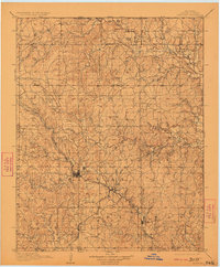
1910 Map of Pawhuska
USGS Topo · Published 1910About this map
The Pawhuska townsite serves as the central hub of this 1910 survey, where the Midland Valley RR bisects the Osage Nation landscape. The map captures a moment of early twentieth-century development, showing the rail corridor connecting settlements like Bigheart, Wynona, and Okesa. The terrain is defined by a dense network of waterways, including the Caney River and the three branches of Bird Creek—North Bird, Middle Bird, and South Bird—which dictate the placement of early crossings like White Swan Ford.
Find a feature on this map
56 named features on this map. Tap any name to fly to it.
Don’t see what you’re looking for? This feature index may not catch every label — zoom into the map to look around manually.
Map Details
Editions of this 1910 Pawhuska Map
2 editions found
Other maps of this area

1885 · Sedan
USGS Topo · 1:125,000

1886 · Independence
USGS Topo · 1:125,000

1889 · Burden
USGS Topo · 1:125,000

1889 · Sedan
USGS Topo · 1:125,000

1894 · Independence
USGS Topo · 1:125,000

1901 · Claremore
USGS Topo · 1:125,000

1901 · Nowata
USGS Topo · 1:125,000

1905 · Independence
USGS Topo · 1:125,000

1906 · Nelagoney
USGS Topo · 1:24,000

1909 · Pawhuska
USGS Topo · 1:125,000