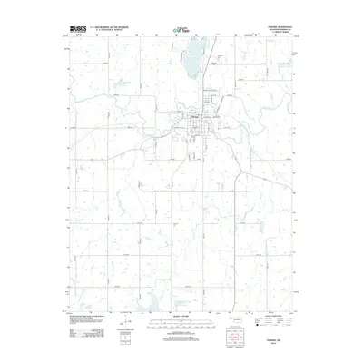
2013 Map of Pawnee
USGS Topo · Published 2013About this map
The city of Pawnee serves as the focal point of this landscape, situated along the winding course of Black Bear Cr. This 2013 survey illustrates a transition from the structured street grid of the town, including namesake thoroughfares like Pawnee Bill Rd, to a rural environment defined by sectional roads and flood control projects. Several large water management sites, such as Lower Black Bear Creek Site 5 Reservoir and Lower Black Bear Creek Site 21 Reservoir, are distributed across the countryside, indicating the region's focus on agricultural water security. Genealogy and local history are preserved in the locations of N Indian Cem, S Indian Cem, and Highland Cem, reflecting the cultural heritage of the area. To the north, Pawnee Lake provides a significant body of water near the junction of Skedee Cr and the larger creek system.
Find a feature on this map
53 named features on this map. Tap any name to fly to it.
Don’t see what you’re looking for? This feature index may not catch every label — zoom into the map to look around manually.
Map Details
Editions of this 2013 Pawnee Map
This is the sole edition of this map. No revisions or reprints were ever made.
Other maps of this area

1929 · Yale
USGS Topo · 1:62,500

1929 · Ripley
USGS Topo · 1:62,500

1929 · Skedee
USGS Topo · 1:62,500

1930 · Pawnee
USGS Topo · 1:62,500

1931 · Skedee
USGS Topo · 1:62,500

1932 · Yale
USGS Topo · 1:62,500

1932 · Ripley
USGS Topo · 1:62,500

1936 · Pawnee
USGS Topo · 1:62,500

1955 · Enid
USGS Topo · 1:250,000

1958 · Enid
USGS Topo · 1:250,000