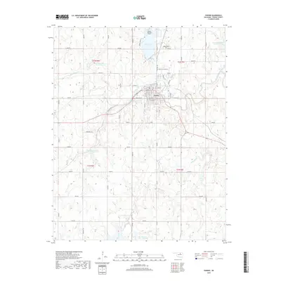
2018 Map of Pawnee
USGS Topo · Published 2018About this map
Pawnee serves as the focal point of this 2018 survey, situated at the confluence of several significant Oklahoma watercourses. The town's layout is defined by a traditional street grid including Illinois St and Harrison St, while the surrounding landscape is marked by an extensive system of flood control and water management. Numerous reservoirs, such as Lower Black Bear Number 17 Reservoir and Lower Black Bear Cr Site 5 Reservoir, dot the terrain along the winding path of Black Bear Creek.
Find a feature on this map
54 named features on this map. Tap any name to fly to it.
Don’t see what you’re looking for? This feature index may not catch every label — zoom into the map to look around manually.
Map Details
Editions of this 2018 Pawnee Map
This is the sole edition of this map. No revisions or reprints were ever made.
Other maps of this area

1929 · Yale
USGS Topo · 1:62,500

1929 · Ripley
USGS Topo · 1:62,500

1929 · Skedee
USGS Topo · 1:62,500

1930 · Pawnee
USGS Topo · 1:62,500

1931 · Skedee
USGS Topo · 1:62,500

1932 · Yale
USGS Topo · 1:62,500

1932 · Ripley
USGS Topo · 1:62,500

1936 · Pawnee
USGS Topo · 1:62,500

1955 · Enid
USGS Topo · 1:250,000

1958 · Enid
USGS Topo · 1:250,000