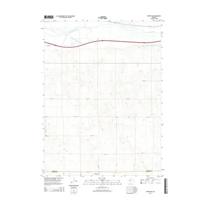
2014 Map of Paxton SW
USGS Topo · Published 2014About this map
The South Platte River carves through the northern edge of this Nebraska landscape, paralleled by the engineered path of the South Platte River Supply Canal. This 2014 survey documents a critical corridor of water management and transportation in the western plains, where the river and canal serve as vital lifelines for the surrounding agricultural terrain. The map captures the boundary between Keith Co and Perkins Co, illustrating a rural landscape defined by a precise grid of county roads such as Road E 10 and Road 341. Near this southern border, Holzfaster's Airport stands as a local aviation landmark, while the northern section is dominated by the heavy transit routes of Us-30 and the Interstate, showing the modern evolution of travel along the historic Platte valley route.
Find a feature on this map
17 named features on this map. Tap any name to fly to it.
Don’t see what you’re looking for? This feature index may not catch every label — zoom into the map to look around manually.
Map Details
Editions of this 2014 Paxton SW Map
This is the sole edition of this map. No revisions or reprints were ever made.
Other maps of this area

1897 · Ogallala
USGS Topo · 1:125,000

1898 · Paxton
USGS Topo · 1:125,000

1900 · Ogallala
USGS Topo · 1:125,000

1901 · Paxton
USGS Topo · 1:125,000

1954 · McCook
USGS Topo · 1:250,000

1954 · North Platte
USGS Topo · 1:250,000

1956 · North Platte
USGS Topo · 1:250,000

1957 · North Platte
USGS Topo · 1:250,000

1957 · McCook
USGS Topo · 1:250,000

1958 · McCook
USGS Topo · 1:250,000