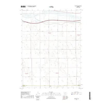
2017 Map of Paxton SW
USGS Topo · Published 2017About this map
The South Platte River and its accompanying South Platte River Supply Canal define the northern edge of this Nebraska landscape, where the water infrastructure supports the agricultural vitality of the High Plains. Just south of the river, a meticulously surveyed grid of section lines and gravel roads, including Rd East 80 and Rd East 70, stretches across the terrain. This rural expanse is marked by the border between Keith Co and Perkins Co, illustrating the geopolitical organization of the region.
Find a feature on this map
17 named features on this map. Tap any name to fly to it.
Don’t see what you’re looking for? This feature index may not catch every label — zoom into the map to look around manually.
Map Details
Editions of this 2017 Paxton SW Map
This is the sole edition of this map. No revisions or reprints were ever made.
Other maps of this area

1897 · Ogallala
USGS Topo · 1:125,000

1898 · Paxton
USGS Topo · 1:125,000

1900 · Ogallala
USGS Topo · 1:125,000

1901 · Paxton
USGS Topo · 1:125,000

1954 · McCook
USGS Topo · 1:250,000

1954 · North Platte
USGS Topo · 1:250,000

1956 · North Platte
USGS Topo · 1:250,000

1957 · North Platte
USGS Topo · 1:250,000

1957 · McCook
USGS Topo · 1:250,000

1958 · McCook
USGS Topo · 1:250,000