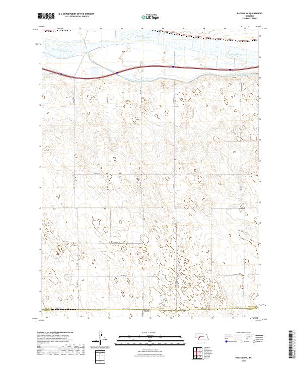
2021 Map of Paxton SW
USGS Topo · Published 2021About this map
The South Platte River and its accompanying South Platte River Supply Canal define the northern edge of this Nebraska landscape, where the flat river valley gives way to the undulating terrain of the High Plains. This part of the Platte valley demonstrates a complex water management system essential to the region's agricultural productivity. To the south, the grid of section lines is reflected in a systematic network of rural roads, including Rd East 80 and Rd East 70, which partition the land into large tracts typical of western Nebraska ranching and farming operations. The southern boundary of Keith Co meets Perkins Co, marked by Rd East 10. A notable landmark in this rural expanse is Holzfaster's Airport, a small landing strip located near the southern county line that serves the local aviation needs of the surrounding agricultural community.
Find a feature on this map
17 named features on this map. Tap any name to fly to it.
Don’t see what you’re looking for? This feature index may not catch every label — zoom into the map to look around manually.
Map Details
Editions of this 2021 Paxton SW Map
This is the sole edition of this map. No revisions or reprints were ever made.
Other maps of this area

1897 · Ogallala
USGS Topo · 1:125,000

1898 · Paxton
USGS Topo · 1:125,000

1900 · Ogallala
USGS Topo · 1:125,000

1901 · Paxton
USGS Topo · 1:125,000

1954 · McCook
USGS Topo · 1:250,000

1954 · North Platte
USGS Topo · 1:250,000

1956 · North Platte
USGS Topo · 1:250,000

1957 · North Platte
USGS Topo · 1:250,000

1957 · McCook
USGS Topo · 1:250,000

1958 · McCook
USGS Topo · 1:250,000