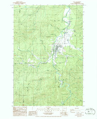
1986 Map of Pe Ell
USGS Topo · Published 1986About this map
Pe Ell serves as the central hub of this mid-1980s landscape, situated where the Chehalis River winds through the Pe Ell Prairie. This survey captures the town's grid and surrounding timberlands just as the era of traditional field checking was being superseded by digital methods. To the west, the settlement of Walville and the winding McCormick Road follow the drainage of Rock Creek, while the southern reaches are defined by the high elevations of Huckleberry Ridge. The area's resource-based economy and local geography are etched into labels like Mullers Mill Canyon Creek and several Borrow Pits. From the secluded Fisk Falls to the family-named landmarks like Janes Bluff and Helmicks Pond, the map provides a precise record of the Lewis and Pacific County borderlands.
Find a feature on this map
39 named features on this map. Tap any name to fly to it.
Don’t see what you’re looking for? This feature index may not catch every label — zoom into the map to look around manually.
Map Details
Editions of this 1986 Pe Ell Map
2 editions found
Other maps of this area

1941 · Walville
USGS Topo · 1:62,500

1941 · Meskill
USGS Topo · 1:62,500

1941 · Skamokawa
USGS Topo · 1:62,500

1953 · Hoquiam
USGS Topo · 1:250,000

1953 · Ryderwood
USGS Topo · 1:62,500

1953 · Skamokawa
USGS Topo · 1:62,500

1953 · Pe Ell
USGS Topo · 1:62,500

1953 · Adna
USGS Topo · 1:62,500

1957 · Hoquiam
USGS Topo · 1:250,000

1958 · Hoquiam
USGS Topo · 1:250,000