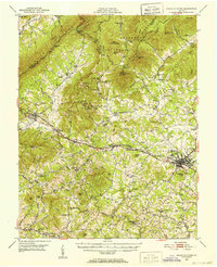
1950 Map of Peaks of Otter
USGS Topo · Published 1952About this map
The Blue Ridge peaks dominate this mid-century survey of the Virginia landscape, where the Jefferson National Forest meets the developed valley floor. The Norfolk and Western railway forms the backbone of transit through the region, connecting Montvale and Thaxton to the bustling hub of Bedford. This era shows a community defined by its water-powered industry and rural congregations, with numerous sites like Penicks Mill and Kelso Mill situated along the many forks of Goose Creek.
Find a feature on this map
94 named features on this map. Tap any name to fly to it.
Don’t see what you’re looking for? This feature index may not catch every label — zoom into the map to look around manually.
Map Details
Editions of this 1950 Peaks of Otter Map
5 editions found

Other maps of this area

1890 · Roanoke
USGS Topo · 1:125,000

1891 · Roanoke
USGS Topo · 1:125,000

1892 · Lynchburg
USGS Topo · 1:125,000

1894 · Natural Bridge
USGS Topo · 1:125,000

1894 · Lexington
USGS Topo · 1:125,000

1894 · Natural Bridge
USGS Topo · 1:62,500

1907 · Natural Bridge Special
USGS Topo · 1:62,500

1913 · Eagle Rock
USGS Topo · 1:48,000

1915 · Eagle Rock
USGS Topo · 1:62,500

1929 · Roanoke
USGS Topo · 1:48,000