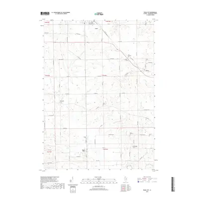
2018 Map of Pearl City
USGS Topo · Published 2018About this map
Pearl City and Lena anchor this corner of Stephenson County, Illinois, where the landscape is defined by the winding course of Yellow Creek. This agricultural region is punctuated by a high density of rural burial sites and churches, often bearing the names of early immigrant congregations, such as the Samel Evangelical Cem and Salem Evangelical Cem near Eleroy. The map reveals a highly structured grid of section roads like W Dameier Rd and W Mound Rd, which traverse the rolling terrain between the Yellow Creek and Preston Creek watersheds. These roads provide access to numerous small cemeteries including Babbs Grove Cem and Grisby Cem, which serve as vital markers for local family histories and genealogists tracing the settlement patterns of northwestern Illinois.
Find a feature on this map
49 named features on this map. Tap any name to fly to it.
Don’t see what you’re looking for? This feature index may not catch every label — zoom into the map to look around manually.
Map Details
Editions of this 2018 Pearl City Map
This is the sole edition of this map. No revisions or reprints were ever made.
Other maps of this area

1937 · Lena
USGS Topo · 1:48,000

1939 · Freeport
USGS Topo · 1:48,000

1942 · Mt Carroll
USGS Topo · 1:62,500

1942 · Lena
USGS Topo · 1:62,500

1942 · Forreston
USGS Topo · 1:62,500

1943 · Lena
USGS Topo · 1:62,500

1944 · Mt Carroll
USGS Topo · 1:62,500

1944 · Freeport
USGS Topo · 1:62,500

1945 · Forreston
USGS Topo · 1:62,500

1954 · Rockford
USGS Topo · 1:250,000