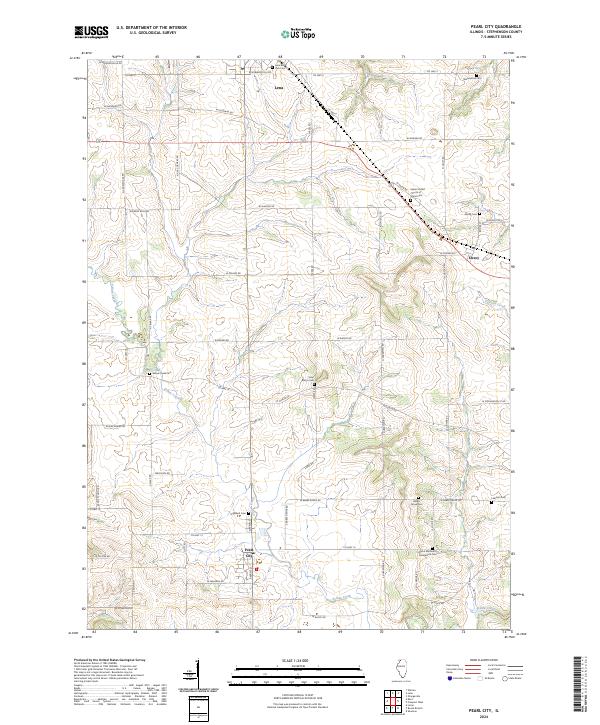
2024 Map of Pearl City
USGS Topo · Published 2024About this map
Pearl City serves as the southern anchor for this Stephenson County landscape, where the meandering course of Yellow Creek cuts through a grid of agricultural section lines. This contemporary survey of the region highlights a high density of small rural cemeteries and church sites, such as Salem United Church of Christ Cem and Saint Marys Cem, which point to the deep-rooted family heritage of the surrounding townships. In the north, the town of Lena occupies the high ground, while the hamlet of Eleroy sits to the east near the headwaters of Preston Creek. The network of local routes, including Co Hwy 5 and W Howardsville Rd, preserves the traditional path of movement between these historic farmsteads and parish centers, offering a detailed look at the modern rural infrastructure of Northern Illinois.
Find a feature on this map
61 named features on this map. Tap any name to fly to it.
Don’t see what you’re looking for? This feature index may not catch every label — zoom into the map to look around manually.
Map Details
Editions of this 2024 Pearl City Map
This is the sole edition of this map. No revisions or reprints were ever made.
Other maps of this area

1937 · Lena
USGS Topo · 1:48,000

1939 · Freeport
USGS Topo · 1:48,000

1942 · Mt Carroll
USGS Topo · 1:62,500

1942 · Lena
USGS Topo · 1:62,500

1942 · Forreston
USGS Topo · 1:62,500

1943 · Lena
USGS Topo · 1:62,500

1944 · Mt Carroll
USGS Topo · 1:62,500

1944 · Freeport
USGS Topo · 1:62,500

1945 · Forreston
USGS Topo · 1:62,500

1954 · Rockford
USGS Topo · 1:250,000