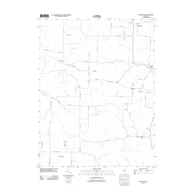
2012 Map of Pearl West
USGS Topo · Published 2012About this map
Tick Ridge and the broad landscape of Old Pearl Prairie dominate this Pike County landscape, defined by a complex network of creeks feeding into the Illinois River basin. The settlement pattern is anchored by Pearl, Old Pearl, and Straut, while smaller clusters like Bee Creek and Greenpond mark the rural intersections. Family history is etched into the land through numerous small burial grounds, including the Hess Cem, Kessinger Cem, and McConnell Cem, which are scattered among the farms of Farmers Ridge. The geography is bisected by several significant watercourses, most notably Bettell Cr and the various forks of Spring Cr. Local aviation and recreation are represented by Bunn Airport and the Mississippi Valley Service Camp, while the unusual Twin Culvert landmark highlights the engineered drainage of this creek-laden territory.
Find a feature on this map
70 named features on this map. Tap any name to fly to it.
Don’t see what you’re looking for? This feature index may not catch every label — zoom into the map to look around manually.
Map Details
Editions of this 2012 Pearl West Map
This is the sole edition of this map. No revisions or reprints were ever made.
Other maps of this area

1924 · Griggsville
USGS Topo · 1:62,500

1926 · Griggsville
USGS Topo · 1:62,500

1926 · Pittsfield
USGS Topo · 1:62,500

1930 · Pearl
USGS Topo · 1:62,500

1930 · Nebo
USGS Topo · 1:62,500

1934 · Nebo
USGS Topo · 1:48,000

1942 · Nebo
USGS Topo · 1:62,500

1948 · Quincy
USGS Topo · 1:250,000

1950 · Pearl
USGS Topo · 1:62,500

1956 · Quincy
USGS Topo · 1:250,000