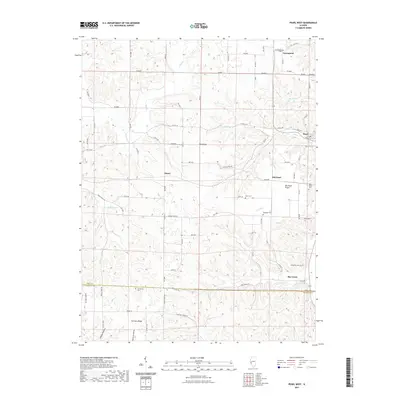
2021 Map of Pearl West
USGS Topo · Published 2021About this map
Tick Ridge and Old Pearl Prairie define the high ground of this western Illinois landscape, where the rugged drainages of the Illinois River valley meet the upland plateaus of Pike and Calhoun counties. The map captures a high density of rural burial grounds, including Greenpond Cem, Hess Cem, Old Pearl Cem, and the Miller Cem, providing a detailed record for genealogical research in small settlements like Old Pearl and Straut. The complex network of seasonal and perennial streams, such as Silkwood Cr, Little Blue Cr, and Lost Cr, illustrates the dissected terrain that influenced early road placement along ridges and through hollows like Bettieview Hollow. This 2021 survey marks the persistent rural character of the region, where the county line between Pike and Calhoun runs south of the small community at Bee Creek.
Find a feature on this map
83 named features on this map. Tap any name to fly to it.
Don’t see what you’re looking for? This feature index may not catch every label — zoom into the map to look around manually.
Map Details
Editions of this 2021 Pearl West Map
This is the sole edition of this map. No revisions or reprints were ever made.
Other maps of this area

1924 · Griggsville
USGS Topo · 1:62,500

1926 · Griggsville
USGS Topo · 1:62,500

1926 · Pittsfield
USGS Topo · 1:62,500

1930 · Pearl
USGS Topo · 1:62,500

1930 · Nebo
USGS Topo · 1:62,500

1934 · Nebo
USGS Topo · 1:48,000

1942 · Nebo
USGS Topo · 1:62,500

1948 · Quincy
USGS Topo · 1:250,000

1950 · Pearl
USGS Topo · 1:62,500

1956 · Quincy
USGS Topo · 1:250,000