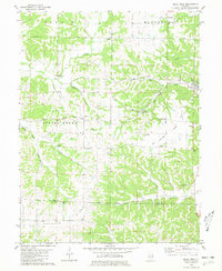
1980 Map of Pearl West
USGS Topo · Published 1981About this map
Tick Ridge and the Spring Creek valley dominate this landscape along the border of Pike and Calhoun Counties. The terrain is characterized by a series of prominent ridges and deep hollows, such as Farmers Ridge and the high ground of Montezuma. Small rural communities and crossroad settlements like Pearl, Greenpond, and Straut are connected by the Illinois Central Gulf railroad and the Gulf Central route. The map reveals a deeply established social fabric evidenced by numerous country churches and family burial grounds, including Nebraska Ch and the Kessinger Cem. Natural landmarks like Twin Culvert Cave and the waters of Silkwood Bay at the Mississippi Valley Service Camp provide a clear view of the local topography and recreational sites as they existed in the late 1970s.
Find a feature on this map
37 named features on this map. Tap any name to fly to it.
Don’t see what you’re looking for? This feature index may not catch every label — zoom into the map to look around manually.
Map Details
Editions of this 1980 Pearl West Map
This is the sole edition of this map. No revisions or reprints were ever made.
Other maps of this area

1924 · Griggsville
USGS Topo · 1:62,500

1926 · Griggsville
USGS Topo · 1:62,500

1926 · Pittsfield
USGS Topo · 1:62,500

1930 · Pearl
USGS Topo · 1:62,500

1930 · Nebo
USGS Topo · 1:62,500

1934 · Nebo
USGS Topo · 1:48,000

1942 · Nebo
USGS Topo · 1:62,500

1948 · Quincy
USGS Topo · 1:250,000

1950 · Pearl
USGS Topo · 1:62,500

1956 · Quincy
USGS Topo · 1:250,000