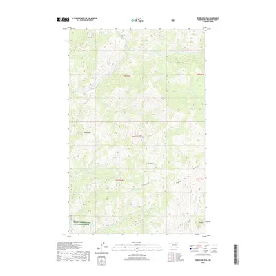
2020 Map of Pearrygin Peak
USGS Topo · Published 2020About this map
Okanogan National Forest dominates this mountainous landscape in Washington, where high summits like Pearrygin Peak and Tripod Peak define the upper reaches of the Methow Valley drainage. The terrain is deeply incised by numerous waterways including Boulder Cr and its various branches, as well as Pearrygin Creek, which flows southwest toward the lower valley. In the southwestern corner of the sheet, the Methow Winter Range and Wildlife Refuge indicates a transition from the higher peaks to protected habitat. Notable landmarks such as Ramsey Peak and First Butte stand above the drainage basins of Ramsey Creek and Bromus Creek, illustrating the complex topography of the eastern Cascades. The map captures a moment of managed conservation and natural wilderness, where ridges like Blue Buck Ridge border the high-elevation forests.
Find a feature on this map
22 named features on this map. Tap any name to fly to it.
Don’t see what you’re looking for? This feature index may not catch every label — zoom into the map to look around manually.
Map Details
Editions of this 2020 Pearrygin Peak Map
This is the sole edition of this map. No revisions or reprints were ever made.
Other maps of this area

1899 · Methow
USGS Topo · 1:125,000

1901 · Methow
USGS Topo · 1:125,000

1905 · Okanogan
USGS Topo · 1:125,000

1906 · Chopaka
USGS Topo · 1:125,000

1954 · Okanogan
USGS Topo · 1:250,000

1955 · Concrete
USGS Topo · 1:250,000

1956 · Loup Loup
USGS Topo · 1:62,500

1956 · Tiffany Mountain
USGS Topo · 1:62,500

1958 · Concrete
USGS Topo · 1:250,000

1958 · Okanogan
USGS Topo · 1:250,000