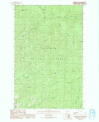
1991 Map of Pearrygin Peak
USGS Topo · Published 1991About this map
Okanogan National Forest dominates this high-country survey, defined by a series of prominent summits and creek drainages in the late 20th century. The topographic data highlights First Butte L O Lookout Tower as a primary vantage point at the northern edge, overlooking the headwaters of Butte Creek and Boulder Creek. This area illustrates the management of public lands for both conservation and resource use, with the Methow State Wildlife Area occupying the southwestern corner. The landscape is a network of ridges and basins, from Blue Buck Ridge to the high reaches of Pearrygin Peak and Tripod Peak. Evidence of light industrial activity is found at a Gravel Pit near Ramsey Creek, while primitive transportation is represented by scattered 4wd routes traversing the drainages of Bear Creek and Blue Buck Creek.
Find a feature on this map
21 named features on this map. Tap any name to fly to it.
Don’t see what you’re looking for? This feature index may not catch every label — zoom into the map to look around manually.
Map Details
Editions of this 1991 Pearrygin Peak Map
This is the sole edition of this map. No revisions or reprints were ever made.
Other maps of this area

1899 · Methow
USGS Topo · 1:125,000

1901 · Methow
USGS Topo · 1:125,000

1905 · Okanogan
USGS Topo · 1:125,000

1906 · Chopaka
USGS Topo · 1:125,000

1954 · Okanogan
USGS Topo · 1:250,000

1955 · Concrete
USGS Topo · 1:250,000

1956 · Loup Loup
USGS Topo · 1:62,500

1956 · Tiffany Mountain
USGS Topo · 1:62,500

1958 · Concrete
USGS Topo · 1:250,000

1958 · Okanogan
USGS Topo · 1:250,000