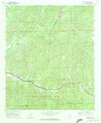
1969 Map of Pearson
USGS Topo · Published 1972About this map
The Gulf Mobile and Ohio railroad corridor anchors this late-1960s landscape, winding through the settlements of Hagler and Pearson. This rural stretch of the Alabama hills is heavily defined by its watercourses, including Big Sandy Creek and the many branches that feed it, such as Lye Branch and Butler Branch. The topography is marked by small-scale industry and infrastructure, notably the Strid Mine in the north and a large pipeline cutting across the northwestern quadrant.
Find a feature on this map
34 named features on this map. Tap any name to fly to it.
Don’t see what you’re looking for? This feature index may not catch every label — zoom into the map to look around manually.
Map Details
Editions of this 1969 Pearson Map
3 editions found
Other maps of this area

1899 · Brookwood
USGS Topo · 1:125,000

1931 · Cottondale
USGS Topo · 1:48,000

1934 · Cottondale
USGS Topo · 1:62,500

1934 · Blocton
USGS Topo · 1:48,000

1940 · Blocton
USGS Topo · 1:62,500

1953 · Montgomery
USGS Topo · 1:250,000

1953 · Birmingham
USGS Topo · 1:250,000

1956 · Birmingham
USGS Topo · 1:250,000

1956 · Montgomery
USGS Topo · 1:250,000

1957 · Birmingham
USGS Topo · 1:250,000