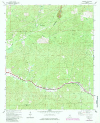
1969 Map of Pearson
USGS Topo · Published 1985About this map
Talladega National Forest covers much of this landscape along the Tuscaloosa and Bibb County line, where small communities and rural churches are connected by the Illinois Central Gulf railroad line. The settlement of Pearson and the nearby Hubbard Springs Ch serve as central points along this transit corridor, which parallels the winding path of Bear Creek. The topography is defined by the ridge at Pearson Gap and numerous drainages like Haysop Creek and Schultz Creek that flow through the dense woodland.
Find a feature on this map
31 named features on this map. Tap any name to fly to it.
Don’t see what you’re looking for? This feature index may not catch every label — zoom into the map to look around manually.
Map Details
Editions of this 1969 Pearson Map
3 editions found
Other maps of this area

1899 · Brookwood
USGS Topo · 1:125,000

1931 · Cottondale
USGS Topo · 1:48,000

1934 · Cottondale
USGS Topo · 1:62,500

1934 · Blocton
USGS Topo · 1:48,000

1940 · Blocton
USGS Topo · 1:62,500

1953 · Montgomery
USGS Topo · 1:250,000

1953 · Birmingham
USGS Topo · 1:250,000

1956 · Birmingham
USGS Topo · 1:250,000

1956 · Montgomery
USGS Topo · 1:250,000

1957 · Birmingham
USGS Topo · 1:250,000