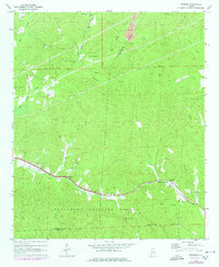
1969 Map of Pearson
USGS Topo · Published 1978About this map
Talladega National Forest covers much of this landscape along the border of Tuscaloosa and Bibb counties, where the Gulf Mobile and Ohio railroad corridor dictates the placement of small settlements and rural infrastructure. The rail line connects the communities of Hagler, Pearson, and Harmon, following the natural passage near Bear Creek. This period shows a transition in land use, from traditional rural gatherings at local houses of worship like Liberty Ch and Hubbard Springs Ch to modern industrial activity at the Strip Mine in the north and the Gravel Pit to the southeast. Water sources such as Big Sandy Spring and Lake Lulu punctuate a terrain defined by ridges and gaps, including the notable Pearson Gap. The map provides a detailed view of the rural South during the late 1960s, capturing the specific locations of family-oriented landmarks and early utility developments like the local Pipeline.
Find a feature on this map
36 named features on this map. Tap any name to fly to it.
Don’t see what you’re looking for? This feature index may not catch every label — zoom into the map to look around manually.
Map Details
Editions of this 1969 Pearson Map
3 editions found
Other maps of this area

1899 · Brookwood
USGS Topo · 1:125,000

1931 · Cottondale
USGS Topo · 1:48,000

1934 · Cottondale
USGS Topo · 1:62,500

1934 · Blocton
USGS Topo · 1:48,000

1940 · Blocton
USGS Topo · 1:62,500

1953 · Montgomery
USGS Topo · 1:250,000

1953 · Birmingham
USGS Topo · 1:250,000

1956 · Birmingham
USGS Topo · 1:250,000

1956 · Montgomery
USGS Topo · 1:250,000

1957 · Birmingham
USGS Topo · 1:250,000