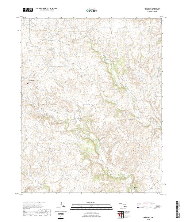
2022 Map of Pearsonia
USGS Topo · Published 2022About this map
The settlement of Pearsonia anchors this section of Osage County, where the topography is defined by the winding drainages of Bird Cr and its tributaries. In this northern Oklahoma landscape, small communities like Blackland and Myers are situated along a network of rural roads, including Co RD 4650 and Co RD 4375. The drainage patterns suggest a complex watershed where N Bird Cr, Middle Bird Cr, and Hickory Cr converge, shaping the terrain between the local sections. This 2022 survey provides a clear view of the modern land divisions and water features like Sand Cr and Dry Cr that have influenced the placement of these historic Osage settlements over time.
Find a feature on this map
23 named features on this map. Tap any name to fly to it.
Don’t see what you’re looking for? This feature index may not catch every label — zoom into the map to look around manually.
Map Details
Editions of this 2022 Pearsonia Map
This is the sole edition of this map. No revisions or reprints were ever made.
Other maps of this area

1909 · Pawhuska
USGS Topo · 1:125,000

1910 · Pawhuska
USGS Topo · 1:125,000

1916 · Foraker
USGS Topo · 1:62,500

1932 · Fairfax
USGS Topo · 1:62,500

1955 · Enid
USGS Topo · 1:250,000

1958 · Enid
USGS Topo · 1:250,000

1960 · Nanos
USGS Topo · 1:24,000

1960 · Pawhuska
USGS Topo · 1:24,000
1973 · Pearsonia
USGS Topo · 1:24,000
1973 · Pearsonia NE
USGS Topo · 1:24,000