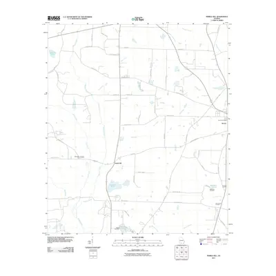
2011 Map of Pebble Hill
USGS Topo · Published 2011About this map
Morven and its surrounding agricultural landscape define this portion of Brooks County, where a network of rural routes and historic pathways like Old Coffee Rd connect scattered homesteads. The terrain is deeply influenced by the drainage of Okapilco Creek and its many tributaries, including Gum Creek and Downing Creek. These waterways, punctuated by features such as Crevasse Pond and McMillian Lake, reflect a landscape managed for local needs, with several earthen structures like Moore Lake Dam visible. Genealogists will find significant value in the distribution of family and community burial grounds, including Kennedy Cemetery near Kennedy Hill, and Mount Horeb Cemetery further east. The area around Pebble Hill shows a transition from open fields to more wooded riparian zones, maintaining the traditional settlement patterns of southern Georgia.
Find a feature on this map
57 named features on this map. Tap any name to fly to it.
Don’t see what you’re looking for? This feature index may not catch every label — zoom into the map to look around manually.
Map Details
Editions of this 2011 Pebble Hill Map
This is the sole edition of this map. No revisions or reprints were ever made.
Other maps of this area

1953 · Waycross
USGS Topo · 1:250,000

1954 · Valdosta
USGS Topo · 1:250,000

1958 · Valdosta
USGS Topo · 1:250,000

1958 · Waycross
USGS Topo · 1:250,000

1959 · Valdosta
USGS Topo · 1:250,000

1961 · Quitman
USGS Topo · 1:62,500

1961 · Hahira West
USGS Topo · 1:24,000

1961 · Ousley
USGS Topo · 1:24,000

1973 · Cecil
USGS Topo · 1:24,000

1974 · Berlin East
USGS Topo · 1:24,000