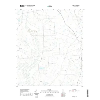
2020 Map of Pebble Hill
USGS Topo · Published 2020About this map
Morven stands as the primary settlement in this corner of Brooks County, characterized by a grid of streets including Fifth St and Gin St adjacent to Railroad St. The surrounding landscape is a low-lying agricultural and wetland plain defined by the meandering course of Okapilco Cr and several tributary branches like Little Cr and Gum Cr. Small rural hubs and family landmarks provide significant points of interest for local historians, notably Kennedy Hill and Pebble Hill. The presence of established burial grounds such as Kennedy Cem, Mount Horeb Cem, and Pine View Cem near McMillian Lake offers tangible connections for genealogical research. The road network, including the Adel Highway 76 and numerous county routes like Coffee Rd, illustrates the persistent rural infrastructure connecting these South Georgia communities.
Find a feature on this map
63 named features on this map. Tap any name to fly to it.
Don’t see what you’re looking for? This feature index may not catch every label — zoom into the map to look around manually.
Map Details
Editions of this 2020 Pebble Hill Map
This is the sole edition of this map. No revisions or reprints were ever made.
Other maps of this area

1953 · Waycross
USGS Topo · 1:250,000

1954 · Valdosta
USGS Topo · 1:250,000

1958 · Valdosta
USGS Topo · 1:250,000

1958 · Waycross
USGS Topo · 1:250,000

1959 · Valdosta
USGS Topo · 1:250,000

1961 · Quitman
USGS Topo · 1:62,500

1961 · Hahira West
USGS Topo · 1:24,000

1961 · Ousley
USGS Topo · 1:24,000

1973 · Cecil
USGS Topo · 1:24,000

1974 · Berlin East
USGS Topo · 1:24,000