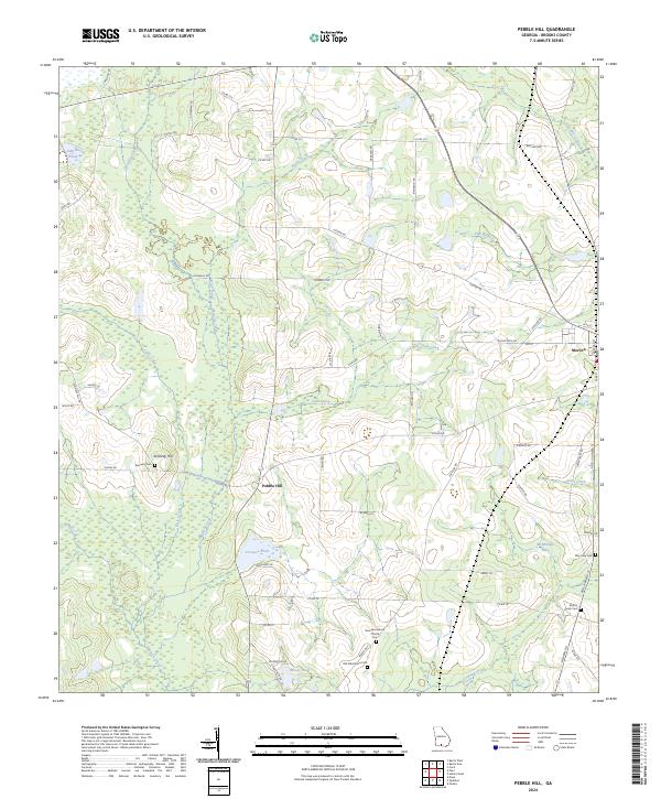
2024 Map of Pebble Hill
USGS Topo · Published 2024About this map
Okapilco Creek and its many tributaries, including Rainy Creek, Gum Creek, and Little Creek, define the agricultural landscape of this Brooks County region. The community of Morven sits at the eastern edge, serving as a local hub near the intersection of several county roads and Adel Highway 76. The rural character is underscored by numerous family and community landmarks, such as Kennedy Hill and the adjacent Kennedy Cem. This map serves as an essential resource for tracing local genealogy and land use patterns, documenting several historical congregational sites like the New Macedonia Church and the nearby Old Macedonia Cem. The distribution of water features, from the large McMillian Lake to the uniquely named Crevasse Pond, reflects the natural drainage and wetland environment of the south Georgia coastal plain.
Find a feature on this map
67 named features on this map. Tap any name to fly to it.
Don’t see what you’re looking for? This feature index may not catch every label — zoom into the map to look around manually.
Map Details
Editions of this 2024 Pebble Hill Map
This is the sole edition of this map. No revisions or reprints were ever made.
Other maps of this area

1953 · Waycross
USGS Topo · 1:250,000

1954 · Valdosta
USGS Topo · 1:250,000

1958 · Valdosta
USGS Topo · 1:250,000

1958 · Waycross
USGS Topo · 1:250,000

1959 · Valdosta
USGS Topo · 1:250,000

1961 · Quitman
USGS Topo · 1:62,500

1961 · Hahira West
USGS Topo · 1:24,000

1961 · Ousley
USGS Topo · 1:24,000

1973 · Cecil
USGS Topo · 1:24,000

1974 · Berlin East
USGS Topo · 1:24,000