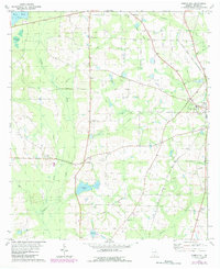
1975 Map of Pebble Hill
USGS Topo · Published 1987About this map
Old Coffee Road cuts across this Brooks County landscape, providing a physical link to one of Georgia's earliest pioneer thoroughfares. The terrain is defined by the winding course of Okapilco Creek and the presence of numerous small water bodies like Crevasse Pond and Brice Pond. The town of Morven sits on the eastern edge of the survey, where local commerce met the transport corridor of the Live Oak Perry and South Georgia railroad.
Find a feature on this map
42 named features on this map. Tap any name to fly to it.
Don’t see what you’re looking for? This feature index may not catch every label — zoom into the map to look around manually.
Map Details
Editions of this 1975 Pebble Hill Map
This is the sole edition of this map. No revisions or reprints were ever made.
Other maps of this area

1953 · Waycross
USGS Topo · 1:250,000

1954 · Valdosta
USGS Topo · 1:250,000

1958 · Valdosta
USGS Topo · 1:250,000

1958 · Waycross
USGS Topo · 1:250,000

1959 · Valdosta
USGS Topo · 1:250,000

1961 · Quitman
USGS Topo · 1:62,500

1961 · Hahira West
USGS Topo · 1:24,000

1961 · Ousley
USGS Topo · 1:24,000

1973 · Cecil
USGS Topo · 1:24,000

1974 · Berlin East
USGS Topo · 1:24,000