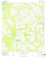
1978 Map of Pebble Hill
USGS Topo · Published 1978About this map
Pebble Hill and the surrounding Brooks County countryside are defined by a dense network of local landmarks and watercourses in the late 1970s. The landscape is notably punctuated by numerous small churches and family-linked sites, such as Salem Ch, Morrison Ch, and St James Cem. These points of assembly suggest a dispersed rural community structured around local congregations. Transportation history is deeply etched into the terrain, visible in the Old Coffee Road and the path of the South Georgia and Florida RR. The area’s hydrology is equally complex, featuring several named bodies of water including Brice Pond, Johnson Pond, and the winding Okapilco Creek. The presence of a Landing Strip and a Lookout Tower near Kennedy Hill further highlights the mix of agricultural utility and regional infrastructure that characterized this part of South Georgia during the era.
Find a feature on this map
40 named features on this map. Tap any name to fly to it.
Don’t see what you’re looking for? This feature index may not catch every label — zoom into the map to look around manually.
Map Details
Editions of this 1978 Pebble Hill Map
This is the sole edition of this map. No revisions or reprints were ever made.
Other maps of this area

1953 · Waycross
USGS Topo · 1:250,000

1954 · Valdosta
USGS Topo · 1:250,000

1958 · Valdosta
USGS Topo · 1:250,000

1958 · Waycross
USGS Topo · 1:250,000

1959 · Valdosta
USGS Topo · 1:250,000

1961 · Quitman
USGS Topo · 1:62,500

1961 · Hahira West
USGS Topo · 1:24,000

1961 · Ousley
USGS Topo · 1:24,000

1973 · Cecil
USGS Topo · 1:24,000

1974 · Berlin East
USGS Topo · 1:24,000