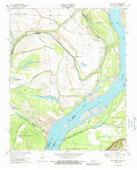
1970 Map of Pecan Point
USGS Topo · Published 1988About this map
Mississippi River riverbanks define the shifting borders of Tennessee and Arkansas in this 1970 survey. The landscape is a complex network of chutes and bars, where the river's historical course is marked by features like Barney Chute (Old River) and Old Brandywine Chute. These waterways isolate large landmasses such as Centennial Island and Dean Island, reflecting the dynamic nature of the alluvial plain. Small settlements and local landmarks are scattered across the higher ground, including Pecan Point and Corona, while several landings like Black Cat Landing and Molasses Pt Landing hint at the river-based commerce and transport of the era.
Find a feature on this map
45 named features on this map. Tap any name to fly to it.
Don’t see what you’re looking for? This feature index may not catch every label — zoom into the map to look around manually.
Map Details
Editions of this 1970 Pecan Point Map
2 editions found
Other maps of this area

1931 · Jericho
USGS Topo · 1:62,500

1939 · Jericho
USGS Topo · 1:62,500

1939 · Evadale
USGS Topo · 1:62,500

1942 · Millington
USGS Topo · 1:62,500

1952 · Jericho
USGS Topo · 1:62,500

1953 · Memphis
USGS Topo · 1:250,000

1956 · Evadale
USGS Topo · 1:62,500

1956 · Memphis
USGS Topo · 1:250,000

1956 · Blytheville
USGS Topo · 1:250,000

1959 · Blytheville
USGS Topo · 1:250,000