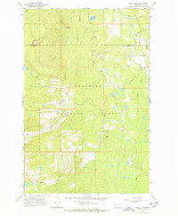
1965 Map of Peck Lake
USGS Topo · Published 1978About this map
The Flathead National Forest dominates this mid-1960s terrain, where the high ridges of the Mission Range drop toward the Swan River valley. The map documents a landscape defined by water and wilderness access, centered on the Jim Creek Lookout Tower which sits at a high elevation overlooking the Jim Creek drainage. This specific era shows the transition of the Montana backcountry from early resource management to established forest infrastructure, including several named Pack Trail routes that navigate the steep slopes between Jim Lake and Peck Lake. At the lower elevations, the watershed of Cold Creek and its branches, North Fork Cold Creek and South Fork Cold Creek, reveal the complex drainage patterns feeding into the valley. Near the eastern edge, a lone Gravel Pit serves as a small marker of local road-building activity during this period of forest development.
Find a feature on this map
17 named features on this map. Tap any name to fly to it.
Don’t see what you’re looking for? This feature index may not catch every label — zoom into the map to look around manually.
Map Details
Editions of this 1965 Peck Lake Map
2 editions found
Other maps of this area

1921 · Elbow Lake
USGS Topo · 1:125,000

1955 · Choteau
USGS Topo · 1:250,000

1957 · Choteau
USGS Topo · 1:250,000

1958 · Choteau
USGS Topo · 1:250,000

1962 · Choteau
USGS Topo · 1:250,000

1965 · Peck Lake
USGS Topo · 1:24,000

1965 · Condon
USGS Topo · 1:24,000

1965 · Swan Peak
USGS Topo · 1:24,000
1965 · Piper-Crow Pass
USGS Topo · 1:24,000
1965 · Cygnet Lake
USGS Topo · 1:24,000