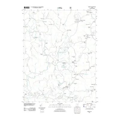
2011 Map of Pedro
USGS Topo · Published 2011About this map
Lawrence Furnace and Buckhorn Furnace anchor this industrial landscape in southern Ohio, where the legacy of iron production and mineral extraction is etched into the terrain. The topography is defined by an intricate network of hollows, such as Vinegar Hollow and Furnace Hollow, which drain into Pine Creek and its many tributaries. By this decade, the local economy shows a distinct shift toward cement production, evidenced by the large Marquette Cement Company Reservoir and the Superior Marquette Cement Company Pond. Small settlements like Pedro, Lisman, and Etna Junction are connected by winding forest roads and rural routes that follow the narrow valley floors. High points in the landscape, such as Periscope Ridge, offer vantage points like the Pilot Knob Lookout Tower, while numerous family and community burial grounds, including Mount Hope Cemetery and Puckett Cemetery, provide essential records for local genealogists tracing the area's early residents.
Find a feature on this map
99 named features on this map. Tap any name to fly to it.
Don’t see what you’re looking for? This feature index may not catch every label — zoom into the map to look around manually.
Map Details
Editions of this 2011 Pedro Map
This is the sole edition of this map. No revisions or reprints were ever made.
Other maps of this area

1898 · Ironton
USGS Topo · 1:62,500

1900 · Ironton
USGS Topo · 1:62,500

1911 · Sciotoville
USGS Topo · 1:62,500

1912 · Oak Hill
USGS Topo · 1:62,500

1913 · Sciotoville
USGS Topo · 1:62,500

1926 · Greenup
USGS Topo · 1:48,000

1930 · Greenup
USGS Topo · 1:62,500

1953 · Greenup
USGS Topo · 1:24,000
1953 · Ironton
USGS Topo · 1:24,000

1957 · Huntington
USGS Topo · 1:250,000