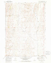
1970 Map of Pegram Creek
USGS Topo · Published 1986About this map
Bear Lake Plateau dominates the central landscape of this 1970 field-checked survey, providing a detailed look at the borderlands where Idaho and Utah meet. The map reveals a highly textured terrain of named canyons and hollows, such as Mahogany Canyon and Cooley Canyon, which cut through the uplifted ridges. At the western edge, the survey captures the upper reaches of Bear Lake State Park, including the drainage from Peterson Hollow and Chokecherry Hollow. The presence of numerous quarries and gravel pits scattered across the slopes indicates localized resource extraction during this era, while a network of jeep trails and a prominent pipeline corridor trace the movement of goods and people through the high country. Names like Bee Hunt Canyon and Trantrum Hollow offer a window into the regional vernacular and early land use patterns of Bear Lake County.
Find a feature on this map
30 named features on this map. Tap any name to fly to it.
Don’t see what you’re looking for? This feature index may not catch every label — zoom into the map to look around manually.
Map Details
Editions of this 1970 Pegram Creek Map
2 editions found
Other maps of this area

1909 · Montpelier
USGS Topo · 1:125,000

1911 · Montpelier
USGS Topo · 1:125,000

1912 · Randolph
USGS Topo · 1:125,000

1954 · Ogden
USGS Topo · 1:250,000

1955 · Preston
USGS Topo · 1:250,000

1958 · Ogden
USGS Topo · 1:250,000

1958 · Preston
USGS Topo · 1:250,000

1960 · Ogden
USGS Topo · 1:250,000

1962 · Preston
USGS Topo · 1:250,000

1967 · Dingle
USGS Topo · 1:24,000