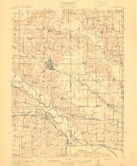
1912 Map of Pella
USGS Topo · Published 1912About this map
Pella stands as a central hub of activity in this 1912 survey, situated between the valleys of the Skunk River and the Des Moines River. The landscape is a detailed map of early twentieth-century rural education and community life, marked by an exceptionally high density of rural schoolhouses such as European School No. 1, Bunker Hill School, and West Amsterdam School. These institutions, spaced every few miles, reflect the township-based settlement patterns of Marion and Mahaska counties before the consolidation of rural districts.
Find a feature on this map
89 named features on this map. Tap any name to fly to it.
Don’t see what you’re looking for? This feature index may not catch every label — zoom into the map to look around manually.
Map Details
Editions of this 1912 Pella Map
2 editions found
Other maps of this area

1909 · Knoxville
USGS Topo · 1:62,500

1910 · Pella
USGS Topo · 1:62,500

1912 · Knoxville
USGS Topo · 1:62,500

1912 · Pella
USGS Topo · 1:62,500

1924 · Melcher
USGS Topo · 1:62,500

1929 · Albia
USGS Topo · 1:62,500

1954 · Des Moines
USGS Topo · 1:250,000

1956 · Des Moines
USGS Topo · 1:250,000

1957 · Des Moines
USGS Topo · 1:250,000

1965 · Monroe
USGS Topo · 1:24,000