
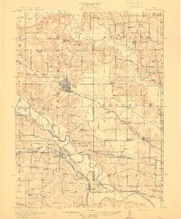
1912 Map of Pella
USGS Topo · Published 1912About this map
Pella sits at the heart of this Marion County landscape, showing a dense street grid and its position as a regional hub before the era of modern highway expansion. The terrain is defined by the convergence of the Des Moines River and the Skunk River, which carve through the townships of Lake Prairie and Black Oak. A sophisticated rail network is evident, with the Chicago Rock Island and Pacific and the Wabash RR facilitating the movement of goods and people between settlements like Harvey, Tracy, and Leighton. Numerous rural schools, such as Flint Ridge School and the European School No 2, are scattered throughout the countryside, illustrating the decentralized educational system of the early 20th century. Local landmarks like Prairie Lake and several country churches, including Bethel Church and Asbury Church, provide specific points of interest for genealogists tracing ancestral homesteads near these community centers.
Find a feature on this map
91 named features on this map. Tap any name to fly to it.
Don’t see what you’re looking for? This feature index may not catch every label — zoom into the map to look around manually.
Map Details
Editions of this 1912 Pella Map
2 editions found
Other maps of this area

1909 · Knoxville
USGS Topo · 1:62,500

1910 · Pella
USGS Topo · 1:62,500

1912 · Knoxville
USGS Topo · 1:62,500

1924 · Melcher
USGS Topo · 1:62,500

1929 · Albia
USGS Topo · 1:62,500

1954 · Des Moines
USGS Topo · 1:250,000

1956 · Des Moines
USGS Topo · 1:250,000

1957 · Des Moines
USGS Topo · 1:250,000

1965 · Monroe
USGS Topo · 1:24,000
1965 · Otley
USGS Topo · 1:24,000