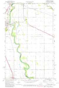
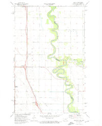
1972 Map of Pembina
USGS Topo · Published 1980About this map
The Red River and Pembina River converge at the historic border settlement of Pembina, marking a critical juncture of geography and international commerce. This area of the Red River Valley is defined by its role as a northern gateway, featuring the Port of Entry US Customs at Noyes and the intricate rail network of the Burlington Northern and Soo Line. The landscape reflects a deeply rooted community structure, with family and local history centered around Lutheran Cem, Joe River Cem, and Evangelical Cem. While the town of St Vincent lies across the river in Minnesota, the proximity of McArthur and the Sultan line illustrates the tight coordination between these border states. Large drainage projects like County Ditch No 28 and County Ditch No 29 emphasize the engineering required to manage this flat, fertile floodplain.
Find a feature on this map
36 named features on this map. Tap any name to fly to it.
Don’t see what you’re looking for? This feature index may not catch every label — zoom into the map to look around manually.
Map Details
Editions of this 1972 Pembina Map
2 editions found
Other maps of this area

1939 · Pembina
USGS Topo · 1:62,500

1941 · Bathgate
USGS Topo · 1:62,500

1941 · Pembina
USGS Topo · 1:62,500

1952 · Thief River Falls
USGS Topo · 1:250,000

1956 · Thief River Falls
USGS Topo · 1:250,000

1957 · Thief River Falls
USGS Topo · 1:250,000

1967 · Thief River Falls
USGS Topo · 1:250,000
1970 · Bathgate SE
USGS Topo · 1:24,000
1970 · Bathgate NE
USGS Topo · 1:24,000
1972 · Joliette
USGS Topo · 1:24,000