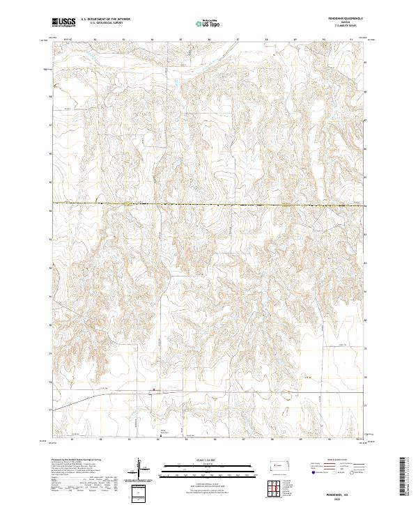
2022 Map of Pendennis
USGS Topo · Published 2022About this map
The Smoky Hill River winds through the northern reaches of this High Plains landscape, marking a terrain defined by deep draws and significant elevation changes along the Gove Co Lane Co boundary. In the southern portion of the quadrangle, the White Rock Cem stands as a focal point for local genealogy, situated near the intersection of Co Rd 250 and Scout. This area is characterized by its rural infrastructure, where a network of section-line roads like Rowdy Rd and Co Rd 260 provide access to the vast agricultural plateaus and the drainage basins of Wild Horse Cr. The naming conventions of local roads and paths, including labels such as Tomahawk and Wichita, reflect the cultural heritage of the Kansas prairie as it transitioned into the twenty-first century.
Find a feature on this map
24 named features on this map. Tap any name to fly to it.
Don’t see what you’re looking for? This feature index may not catch every label — zoom into the map to look around manually.
Map Details
Editions of this 2022 Pendennis Map
This is the sole edition of this map. No revisions or reprints were ever made.
Other maps of this area

1955 · Scott City
USGS Topo · 1:250,000

1958 · Scott City
USGS Topo · 1:250,000

1965 · Utica SW
USGS Topo · 1:24,000

1974 · Gove SW
USGS Topo · 1:24,000

1974 · Gove SE
USGS Topo · 1:24,000

1974 · Castle Rock
USGS Topo · 1:24,000

1974 · Shields NW
USGS Topo · 1:24,000

1974 · Pendennis
USGS Topo · 1:24,000

1974 · Shields SE
USGS Topo · 1:24,000
1974 · Shields
USGS Topo · 1:24,000