
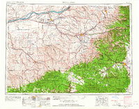
1953 Map of Pendleton
USGS Topo · Published 1957About this map
The Columbia River forms the northern lifeline of this mid-century landscape, dominated by the rise of infrastructure and military installations during the early Cold War. Recent engineering projects like McNary Dam near Umatilla and Power City have reshaped the river's flow, while the inland territory is defined by the massive footprint of the Umatilla Ordnance Depot and the Boardman Bombing and Gunnery Range.
Find a feature on this map
95 named features on this map. Tap any name to fly to it.
Don’t see what you’re looking for? This feature index may not catch every label — zoom into the map to look around manually.
Map Details
Editions of this 1953 Pendleton Map
4 editions found
Other maps of this area

1901 · Baker City
USGS Topo · 1:125,000

1901 · Sumpter
USGS Topo · 1:125,000

1906 · Telocaset
USGS Topo · 1:125,000

1906 · Blalock Island
USGS Topo · 1:125,000

1908 · Blalock Island
USGS Topo · 1:125,000

1908 · Umatilla
USGS Topo · 1:125,000

1910 · Zillah
USGS Topo · 1:125,000

1915 · Wallulah
USGS Topo · 1:96,000

1915 · Prosser
USGS Topo · 1:125,000

1916 · Arlington
USGS Topo · 1:125,000