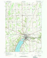
1942 Map of Penn Yan
USGS Topo · Published 1990About this map
Penn Yan serves as the hub of this Yates County landscape, situated where the Keuka Lake waters feed into the New York Central Outlet. The 1942 survey reveals an industrial corridor defined by water power, with Seneca Mills, Milo Mills, and Keuka Mills all situated along the outlet downstream from the main settlement. The surrounding townships of Benton, Torrey, and Milo are characterized by a dense network of district schools and family cemeteries, including Cole Cem and Baldwin Cem. Transport and commerce are anchored by the Pennsylvania Railroad line, which connects the heart of the village to outliers like Bellona Sta and Milo Center. This era of documentation shows the Finger Lakes region in a period of established agricultural and milling activity, with small rural nodes like Havens Corners and Benton Center providing local community centers.
Find a feature on this map
39 named features on this map. Tap any name to fly to it.
Don’t see what you’re looking for? This feature index may not catch every label — zoom into the map to look around manually.
Map Details
Editions of this 1942 Penn Yan Map
4 editions found
Other maps of this area

1902 · Geneva
USGS Topo · 1:62,500

1902 · Phelps
USGS Topo · 1:62,500

1902 · Ovid
USGS Topo · 1:62,500

1903 · Penn Yan
USGS Topo · 1:62,500

1942 · Penn Yan
USGS Topo · 1:31,680

1942 · Pulteney
USGS Topo · 1:31,680

1942 · Rushville
USGS Topo · 1:31,680

1942 · Potter
USGS Topo · 1:31,680

1942 · Stanley
USGS Topo · 1:31,680

1942 · Dundee
USGS Topo · 1:24,000