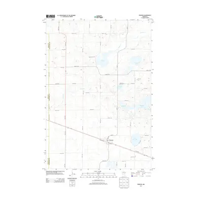
2013 Map of Pennock
USGS Topo · Published 2013About this map
Pennock serves as the primary hub of this prairie landscape, situated along the southern corridor where Us-12 and the rail line follow Pacific Ave SW and Pacific Ave SE. The town's local services are anchored by the Post Office, which supports a surrounding agricultural district defined by large-scale operations like Youngren Dairy Farms. This region of Kandiyohi County is characterized by a dense concentration of glacial basins, including Swan Lake, Mamre Lake, and Church Lake, many of which are connected by the meandering Shakopee Cr. For genealogists and local historians, several landmarks offer a connection to early settlement patterns, notably the Mamrelund Lutheran Cem, Salem Cem, and Saint John's Cem found near the township borders.
Find a feature on this map
40 named features on this map. Tap any name to fly to it.
Don’t see what you’re looking for? This feature index may not catch every label — zoom into the map to look around manually.
Map Details
Editions of this 2013 Pennock Map
This is the sole edition of this map. No revisions or reprints were ever made.
Other maps of this area

1953 · Saint Cloud
USGS Topo · 1:250,000

1957 · Saint Cloud
USGS Topo · 1:250,000

1958 · Saint Cloud
USGS Topo · 1:250,000

1958 · Kerkhoven SE
USGS Topo · 1:24,000

1958 · Kerkhoven
USGS Topo · 1:24,000

1958 · Raymond
USGS Topo · 1:24,000

1958 · Pennock
USGS Topo · 1:24,000

1958 · Willmar
USGS Topo · 1:24,000

1958 · Solomon Lake
USGS Topo · 1:24,000

1967 · Mount Tom
USGS Topo · 1:24,000