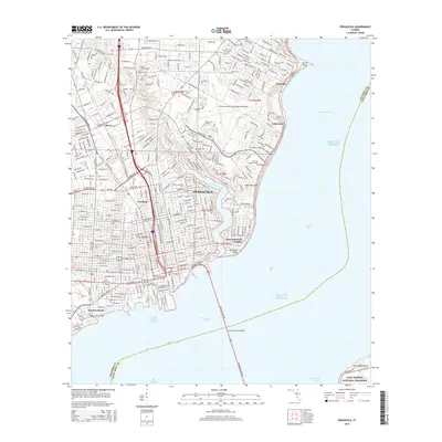
2015 Map of Pensacola
USGS Topo · Published 2015About this map
Pensacola and its surrounding coastal neighborhoods are mapped here at the height of the mid-2010s, showing a densely developed urban landscape defined by its relation to Escambia Bay and Pensacola Bay. The map highlights a significant concentration of historic burial grounds and institutions, ranging from the central Saint Michaels Cem and Clopton Cem to the northern Roberts Cem. Educational hubs like Pensacola Jr Coll and Virginia College-Pensacola anchor the suburban growth between the city center and the Pensacola Gulf Coast Regional Airport. Along the shoreline, the residential character of East Pensacola Heights and the prominent Magnolia Bluff overlook the water, while the Pensacola Bay Bridge provides the primary link across the bay toward the protected lands of the Gulf Islands National Seashore at the southern edge of the sheet.
Find a feature on this map
55 named features on this map. Tap any name to fly to it.
Don’t see what you’re looking for? This feature index may not catch every label — zoom into the map to look around manually.
Map Details
Editions of this 2015 Pensacola Map
This is the sole edition of this map. No revisions or reprints were ever made.
Other maps of this area

1920 · Milton
USGS Topo · 1:62,500

1921 · Pensacola
USGS Topo · 1:62,500

1921 · Fort Barrancas
USGS Topo · 1:62,500

1921 · Muscogee
USGS Topo · 1:62,500

1941 · Fort Barrancas
USGS Topo · 1:62,500

1941 · Muscogee
USGS Topo · 1:62,500

1941 · Pensacola
USGS Topo · 1:62,500

1941 · Milton
USGS Topo · 1:62,500

1942 · Pensacola
USGS Topo · 1:62,500

1943 · Muscogee
USGS Topo · 1:62,500