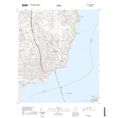
2021 Map of Pensacola
USGS Topo · Published 2021About this map
Pensacola stands as the centerpiece of this 2021 survey, illustrating the modern footprint of Florida's westernmost coastal city. The dense urban grid is anchored by civic and educational landmarks including the M C Blanchard Judicial Building and Pensacola State College, while the Pensacola International Airport occupies a significant portion of the northeastern landscape. The city's geography is defined by its deep relationship with the water, as the Bayfront Pkwy curves along the coastline toward the massive Pensacola Bay Brg.
Find a feature on this map
48 named features on this map. Tap any name to fly to it.
Don’t see what you’re looking for? This feature index may not catch every label — zoom into the map to look around manually.
Map Details
Editions of this 2021 Pensacola Map
This is the sole edition of this map. No revisions or reprints were ever made.
Other maps of this area

1920 · Milton
USGS Topo · 1:62,500

1921 · Pensacola
USGS Topo · 1:62,500

1921 · Fort Barrancas
USGS Topo · 1:62,500

1921 · Muscogee
USGS Topo · 1:62,500

1941 · Fort Barrancas
USGS Topo · 1:62,500

1941 · Muscogee
USGS Topo · 1:62,500

1941 · Pensacola
USGS Topo · 1:62,500

1941 · Milton
USGS Topo · 1:62,500

1942 · Pensacola
USGS Topo · 1:62,500

1943 · Muscogee
USGS Topo · 1:62,500