
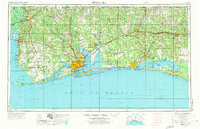
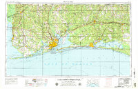
1957 Map of Pensacola
USGS Topo · Published 1967About this map
Pensacola and the surrounding Gulf Coast coastline are depicted here during a period of significant military and infrastructure growth. This survey captures a landscape defined by its complex waterways and the heavy presence of the United States Navy and Air Force, featuring NAS Pensacola and Eglin Air Force Base. Along the coast, the barrier islands and sounds are clearly delineated, including the long stretch of Santa Rosa Island and protected areas like Fort Pickens State Park and Gulf State Park.
Find a feature on this map
211 named features on this map. Tap any name to fly to it.
Don’t see what you’re looking for? This feature index may not catch every label — zoom into the map to look around manually.
Map Details
Editions of this 1957 Pensacola Map
3 editions found
Other maps of this area

1920 · Milton
USGS Topo · 1:62,500

1920 · Robertsdale
USGS Topo · 1:62,500

1921 · Holley
USGS Topo · 1:62,500

1921 · Bon Secour
USGS Topo · 1:62,500

1921 · Pensacola
USGS Topo · 1:62,500

1921 · Point Clear
USGS Topo · 1:62,500

1921 · Fairhope
USGS Topo · 1:62,500

1921 · Dauphin Island
USGS Topo · 1:62,500

1921 · Fort Barrancas
USGS Topo · 1:62,500

1921 · Muscogee
USGS Topo · 1:62,500