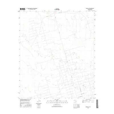
2016 Map of Penwell SW
USGS Topo · Published 2016About this map
McKnight Ranch and the surrounding expanse of Crane County are defined by a dense grid of service roads and industrial infrastructure in this 2016 survey. The landscape is dominated by the geometric patterns of energy extraction, with a network of access ways including Fuller Rd and Fm 1053 N cutting across the terrain. To the south, specialized routes such as Sandhills Warren Plant Rd and Sandhills Headquarters Rd point toward the specific industrial operations that drive the local economy. This map provides a detailed look at the modern West Texas oil patch, where the traditional ranching heritage, represented by Mcknight Ranch Rd, exists alongside high-intensity infrastructure. The topographical detail reveals the subtle undulations of the Permian Basin floor, intersected by paths like Burnett Rd and Shumm Rd.
Find a feature on this map
8 named features on this map. Tap any name to fly to it.
Don’t see what you’re looking for? This feature index may not catch every label — zoom into the map to look around manually.
Map Details
Editions of this 2016 Penwell SW Map
This is the sole edition of this map. No revisions or reprints were ever made.
Other maps of this area

1954 · Pecos
USGS Topo · 1:250,000

1957 · Pecos
USGS Topo · 1:250,000

1964 · Metz
USGS Topo · 1:24,000

1964 · Penwell SW
USGS Topo · 1:24,000

1964 · Penwell
USGS Topo · 1:24,000

1964 · Penwell SE
USGS Topo · 1:24,000

1968 · Monahans SE
USGS Topo · 1:24,000

1968 · Cowden Place
USGS Topo · 1:24,000

1969 · Ozark Lake
USGS Topo · 1:24,000

1974 · Tubbs Corner
USGS Topo · 1:24,000