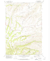
1971 Map of Peola
USGS Topo · Published 1974About this map
Peola serves as the central focal point of this 1970s landscape, situated where the high plateaus of Garfield and Asotin counties meet the northern boundaries of the Umatilla National Forest. The map documents a rugged terrain defined by significant drainage systems and ridgelines, including Knotgrass Ridge and Tam Ridge. For genealogists and local historians, the Pioneer Cemetery and another Cem on Pleasant Ridge provide specific points of interest for tracing early families in this remote corner of Washington.
Find a feature on this map
49 named features on this map. Tap any name to fly to it.
Don’t see what you’re looking for? This feature index may not catch every label — zoom into the map to look around manually.
Map Details
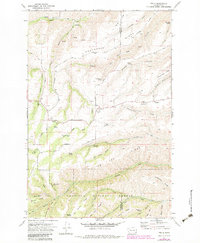
Editions of this 1971 Peola Map
2 editions found
Other maps of this area

1937 · Pomeroy
USGS Topo · 1:96,000

1942 · Pomeroy
USGS Topo · 1:125,000

1943 · Peola
USGS Topo · 1:62,500

1943 · Saddle Butte
USGS Topo · 1:62,500

1946 · Saddle Butte
USGS Topo · 1:62,500

1946 · Peola
USGS Topo · 1:62,500

1955 · Pullman
USGS Topo · 1:250,000

1958 · Pullman
USGS Topo · 1:250,000

1967 · Rose Springs
USGS Topo · 1:24,000
1967 · Pomeroy
USGS Topo · 1:24,000